

Middle Hill [Roughside Hill]
Good walks are even better shared.
NT3346 : Fence post with antler moss, Middle Hill.
Chris Eilbeck Photo source
Overview
Middle Hill [Roughside Hill]
Nestled in the North Pennines, Middle Hill stands at an elevation of 388 meters, making it a fantastic hike for both seasoned trekkers and the more casual walker looking to enjoy the wonderful scenery without (too much) sweat.
Geology
Middle Hill is primarily formed from Millstone Grit, adding to the rugged charm of the area. You'll appreciate its sturdy composition as you wander this rocky terrain, which has been naturally shaped over eons by the elements. Don’t forget to take a moment to look at the interesting rock formations along the way!
Routes
One popular route starts from Blanchland, a delightful village where you can snap a few photos of the historic buildings before you set off. The Roughside Route is moderately challenging, spanning 5.2 km and generally taking about 2.5 hours to complete. It offers a mixture of grassy paths and rocky outcrops, all while providing panoramic views that’ll make your Instagram feed the envy of all your mates.
Summit Features
Upon reaching the summit, you'll find a simple yet dignified cairn marking the spot. There are no trig points here, just a wonderful reminder of those who've trekked before you and a perfect spot to catch your breath while soaking in the views.
Terrain Type
The terrain is quite varied, with greens and golds of expansive grasslands contrasted by rocky outcrops. Just watch your step—those bogs have a sneaky way of appearing out of nowhere!
Views
From the summit, you'll be enamoured by spectacular sights of not just the nearby Roughside Hill, but also the far reaches of the Cheviots. Spring and early autumn are particularly splendid times to visit, as the flora blooms vibrantly, painting the landscape in mesmerizing hues.
Hazards
As always in the hills, be prepared for changeable weather. The terrain can become slippery when wet, and those bogs will surely grab your boots if you’re not careful. Always check the forecast before heading out!
Nearby Summits
If you’re feeling adventurous, consider traversing to the nearby Roughside Hill or Crawley Fell. They provide an enriching experience and are part of the lovely patchwork of the North Pennines.
Access
For those driving in, there is limited roadside parking near Blanchland. The closest bus service runs from Hexham, making it relatively accessible by public transport. Hexham also offers a good range of facilities for food and restrooms, so make sure to stock up before hitting the trail.
Facilities
After your hike, revitalize at the local pub in Blanchland, where you can discuss your triumphs (or near misses) over a pint.
History
The name 'Middle Hill' signifies its location among surrounding hills, whilst 'Roughside Hill' aptly reflects its rugged nature. The North Pennines boasts a rich history, once bustling with lead mining, the remnants of which you may find scattered throughout.
So, lace up your boots, pack a snack, and enjoy the journey up Middle Hill. Just remember not to look down—unless you want to meet the soggy ground up close!
Explore routes near Middle Hill [Roughside Hill]
Walks starting near this hill. Open a route to check its map, distance and full itinerary.
Peebles to Neidpath Castle: Tweed Riverside Walk
View route
Cademuir Forest Pilots Trail
View route
Lauder Burn Mill and Chester Hill Circuit
View route
Selkirk Ettrick Water North Riverside Circuit
View route
Route planning notes
These notes describe possible approaches. Check a route's map and access information when planning your walk.
The Roughside Route
Starting from the small parking area near the village of Blanchland, this route winds through scenic moorland and gently ascends towards the summit.
Make a day of it, together
Find someone to share the walk with, or organise a day out along a route you like.
Photo Gallery
View all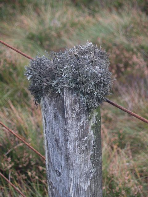 Photo could not load
NT3346 : Fence post with antler moss, Middle Hill.
Chris Eilbeck
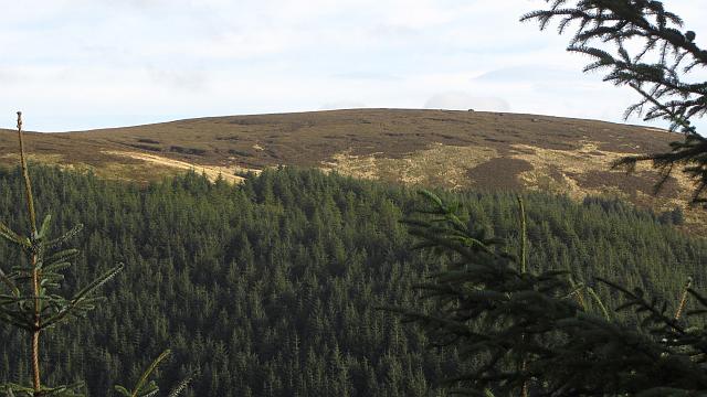 Photo could not load
NT3345 : Middle Hill
Richard Webb
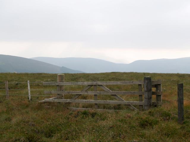 Photo could not load
NT3345 : Gate, Middle Hill.
Chris Eilbeck
Hill facts and local notes
Classifications
Elevation
607m
1,992 ft
Prominence
30m
Coordinates
55.7017, -3.0657
NT331458
OS Map
73
Explorer: 337
At the Summit
At the summit, you'll find a modest cairn commemorating previous adventurers, along with stunning views of the surrounding fells. No fancy trig points here, just nature's own design!
Terrain & Geology
Middle Hill primarily consists of Millstone Grit, a durable sandstone that has weathered into interesting formations. This geological feature is quite common in the North Pennines and lends itself to dramatic cliff-scapes and rich heather moorlands.
Views & Scenery
On a clear day, you can see as far as the Cheviots and the North Pennine foothills, with the rolling landscape dotted by patches of woodland and farmland.
History & Heritage
Name Origin
The name 'Middle Hill' refers to its geographical position amidst several other hills, while 'Roughside Hill' likely refers to the rugged terrain that characterises this area.
Historical Significance
The North Pennines is an Area of Outstanding Natural Beauty, known for its rich industrial heritage, with remnants of lead mining still visible in the landscape.
Getting There & Facilities
Parking
There is limited road-side parking near Blanchland, but ensure you're not blocking any gateways or driveways.
Public Transport
The nearest bus service can be caught from Hexham, which offers a combination of routes to reach Blanchland.
Nearby Facilities
Blanchland has a charming pub offering refreshments, and nearby towns provide additional amenities such as cafes and public toilets.
Safety Information
Known Hazards
- Keep an eye out for sudden weather changes typical of the region. The terrain can be uneven, and be cautious of boggy areas, particularly after rainfall.
General Safety Tips
- Check weather conditions before setting out
- Carry appropriate clothing and equipment
- Let someone know your planned route
- Take a map, compass, and GPS device
- Carry emergency supplies: food, water, first aid kit, torch
Hills
Some common questions about the hills answered
Are there group walks up Middle Hill [Roughside Hill]?
Many walkers use Walkmates to join or organise walks with others. You can check for group walks around Middle Hill [Roughside Hill] through the maps
Are there other walkers around Middle Hill [Roughside Hill]?
Activity varies by location and time, but Walkmates lets you see whether others have shared walks or shown interest in this area. Find other people through the walking friends search walking friends for Middle Hill [Roughside Hill] search or of course create your own walk for Middle Hill [Roughside Hill]
Can I organise a walk to Middle Hill [Roughside Hill]?
Yes. If there aren’t any walks listed already, you can create a walk and make it available for others to join.
If you're signed up to Walkmates, you can create a walk to Middle Hill [Roughside Hill].
How do I find a walk up this hill?
There are often multiple ways to walk this hill, depending on experience and route preference. Walkmates helps you explore walks and routes that others have shared.
Can I suggest a new route up Middle Hill [Roughside Hill]?
Yes. You can suggest or create routes to share with others. Walkmates focuses on the social side of walking, so routes are used to help people organise walks and explore areas together, rather than as detailed navigation tools or route libraries.
Other uses really appreciate knowledgeable walkers sharing their routes. Share your favourite route to Middle Hill [Roughside Hill] here
The is an error or something incorrect about this hill. How do I let you know?
We always strive to keep the information on Walkmates as accurate as possible. If you find an error, please let us know through the contact form and we'll aim to correct it as quickly as possible
Community Discussion
Comments
Location
![Middle Hill [Roughside Hill] location map](https://cdn.walkmates.com/hill-maps/hill-sources/7290/55.70171_-3.06569.png)
Grid reference: NT331458
View on OpenStreetMapOpens a map in a new tab, centred on the hill.


No comments yet. Be the first.